Directions
Tijuana, Mexico Border Crossing

The drive from the U.S./MX border at Tijuana to Colonia Vicente Guerrero is about 175 miles, and takes about 4.5 hours. Once across the U.S.-Mexico border, you will follow signs to Rosarito/Ensenada, Highway 1D Cuota. The drive along the Pacific Ocean on Mexico’s Highway 1D from Tijuana to Ensenada (70 miles) is breathtaking! This section of the highway is a toll road (cuota). You will pass through three toll booths between Tijuana and Ensenada, at approximately $2 each. Toll can be paid in either dollars or pesos. This section of road is a well-maintained, four-lane highway.
Ensenada
After the third toll booth, you will be reaching the metropolitan area of Ensenada. At one point there is a “Y” in the road; you should keep to the right. As you enter the heart of Ensenada, you will be driving along the harbor/port area on Blvd Lazaro Cardenas. You may see a gigantic Mexican flag at the waterfront park, and may see a cruise ship or two berthed there. Continue through this tourist zone, heading south through several stop signs (alto) and traffic lights. Look for a Pemex (gas) station on the left hand side at an intersection with a traffic light; the street name is Gral. Augustin Sanguines. Turn left at this light and head east through one traffic light and a stop sign, to a major boulevard called Avenida Reforma. You will turn right onto Reforma; there is a highway sign here, indicating Hwy 1 to San Quintin. Once you turn right, you just stay on that road heading south, all the way into Vicente Guerrero (another 2.5 hours or so). Along Reforma you will pass a WalMart, McDonald’s and Home Depot on your right, as well as a Costco on your left.
Heading south from Ensenada, the four-lane highway narrows to two lanes and winds through the hills to the San Quintin Valley. You will drive through several small settlements before arriving at Vicente Guerrero. There is one military checkpoint along Highway 1, south of Ensenada, where armed soldiers are inspecting cars for drugs and weapons. Heading south, you most likely will be waved right through. On your return north, however, you will likely be stopped and possibly asked to step out as your vehicle is inspected. This is serious business and you and your passengers should not joke about having drugs or guns!
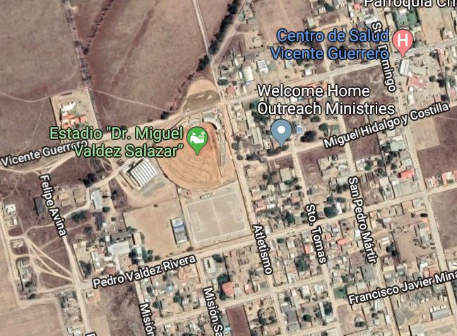
Vicente Guerrero
Approaching Vicente Guerrero, you will cross a four-lane bridge (Puente Santo Domingo) spanning a dry river bed (arroyo). Once across the Santo Domingo bridge, you are in Vicente Guerrero.
Continue to the first traffic light in Vicente Guerrero, about one-half mile past the bridge. (You will have driven almost exactly 175 miles from the San Ysidro/Tijuana border crossing.) At this traffic light, turn right (west) and go one long block to a four-way stop where the pavement ends. Proceed straight for two more blocks (dirt road), then turn left.
Go one block and on your right you will see the back of Welcome Home (Casa Hogar Bienvenidos), a concrete block wall. Turn right to get to the main gate entrance for Welcome Home.